

The Position screen
Position is the first tab. It shows where you stand, in panels you choose, with one button to keep the spot as a mark.
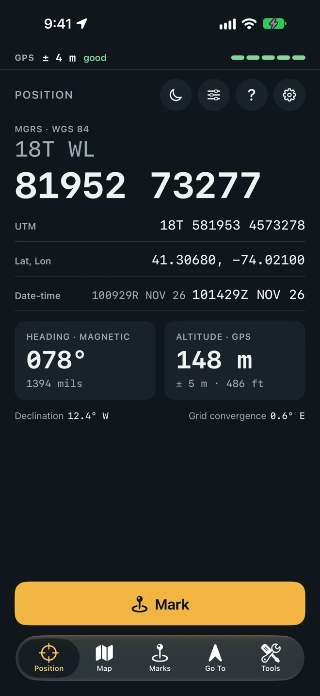
The GPS bar
Section titled “The GPS bar”The strip across the top of every screen says how good the position is right now.
- ± a distance is the phone’s own estimate of how far off the position may be. See Accuracy.
- A word, on Position: good, fair or poor. On the other tabs your current grid takes its place.
- A meter of five steps.
| The bar reads | When |
|---|---|
| good | The accuracy is better than 10 m. The meter shows five steps under 5 m and four under 10 m. |
| fair | 10 m to under 20 m. Three steps. |
| poor | 20 m or worse. Two steps under 65 m, one beyond. |
| indoors? | The newest fix has no speed and is looser than 30 m. That is the phone placing itself from Wi-Fi or cell towers, usually under a roof. |
| approximate | The accuracy is 1,000 m or worse. Precise Location is off for Geo Marker. |
| No fix yet | No position has arrived since the screen opened. |
| Location is off | Geo Marker is not allowed to use your location. |
| GPS lost, showing the last position | No position is coming in. The screens below still show the last one. |
The grid
Section titled “The grid”The large panel is your grid, labeled MGRS · WGS 84. The zone and the 100 km square sit on the
first line (18T WL), the easting and northing on the second (83134 73935). Tap it to copy the
whole reference.
The grid is always shown to the meter. MGRS truncates: the reference names the square that contains you, so its last digit can sit one below the UTM line, which rounds.
Beyond 84° north and 80° south there is no MGRS grid in this app. The panel says MGRS near the poles is not supported here. Use latitude and longitude.
The other panels
Section titled “The other panels”Each row copies its value when you tap it.
| Panel | Shows |
|---|---|
| UTM | Zone, band, easting and northing in meters. |
| Lat, Lon | Latitude and longitude in decimal degrees. |
| Deg, min | Degrees and decimal minutes. |
| D, M, S | Degrees, minutes and seconds. |
| Plus Code | The Open Location Code of the spot. |
| Date-time | The date-time group twice: local time with its zone letter, then Zulu, as in 091730Z NOV 26 (the 9th, 17:30 UTC). Local time shows J where the offset from UTC is not a whole number of hours. |
| Declination and Grid convergence | The two angles between the three norths where you stand. See Grid, magnetic and true north. |
Four panels are cards that sit two to a row:
| Card | Shows |
|---|---|
| Heading | The way the top of the phone points, with the north it is read from in the label (Heading · grid). The small line gives the same angle in the other unit, mils or degrees. With no compass it reads No compass. |
| Altitude | Your height in meters, with its own ± and the height in feet. See below. |
| Speed | Your speed in km/h, with mph under it, or Standing still. |
| Go To target | The name of the mark you are walking to, its distance and azimuth. Tap it to open Go To. With nothing chosen it reads No target. |
Altitude
Section titled “Altitude”The label says where the height comes from.
- Altitude · GPS: a GPS height the phone puts within 8 m. The line under it gives the ± and the height in feet.
- Altitude · ground: the height of the ground where you stand, from ObjectGraph’s elevation service. This shows only when Look Up Ground Height is on in Settings and the GPS height is looser than 8 m. It needs a connection.
- Altitude · GPS, rough: a GPS height looser than 8 m, shown gray with its ± in the accent color. Read the ±.
- No height yet: no height has arrived.
Choose the panels
Section titled “Choose the panels”Tap the sliders button (Choose panels) to open Position Panels.
- Tap the check mark beside a panel under Shown, top to bottom to hide it.
- Tap the circle beside a panel under Hidden to show it.
- Drag a shown panel to change the order.
- Reset to the Standard Panels puts back the standard set.
The standard set is MGRS grid, large, UTM, Latitude, longitude, Date-time group, Heading, Altitude and Declination and grid convergence. Degrees, minutes, Degrees, minutes, seconds, Plus Code, Speed and Go To target start hidden.
Mark the spot
Section titled “Mark the spot”Mark at the bottom opens New mark on Here, with the grid where you stand and its ±. Type a name or keep the suggested one, pick a folder, and tap Save. See Marks.
Night mode
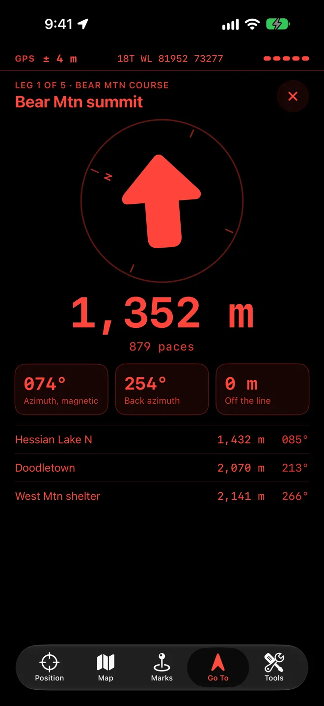
Section titled “Night mode”Tap the moon at the top of Position. The five tabs, the mark sheets and the tools turn red on black, and the map is tinted red and dimmed. Tap the moon again to leave night mode.
Before the first fix
Section titled “Before the first fix”Position reads Finding your position… until a fix arrives. It needs no signal, only a view of the sky. If the screen reads Geo Marker needs your location to show your grid., tap Open Settings and allow location. See Troubleshooting.