Print and PDF reports
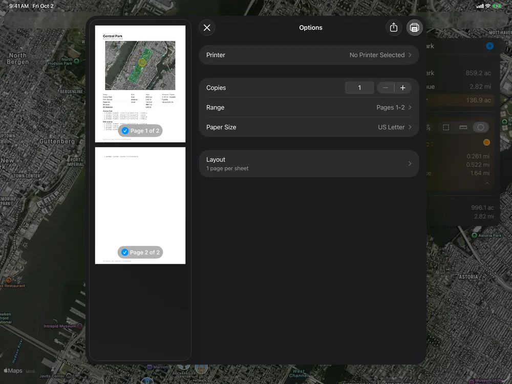
Print… (More menu, or File › Print… ⌘P on the Mac) and Export › PDF Report open the print sheet: the page as it will print, beside the choices on the Mac and iPad and above them on iPhone. The page is made again a moment after each change.
What goes on the paper
- All Shapes or Selected Shape, when a shape is selected and the two would print different shapes. All Shapes prints every shown layer; hidden layers are left out.
- Map: the map picture, in Standard, Muted, Satellite or Hybrid (it starts as the screen’s style; a 3D style prints flat). On the map: Shapes, and with them Names and values, Side lengths and Point numbers.
- On the Page: Shapes and totals, a table of every shape with its kind, value, perimeter and point count (a circle’s radius), and the totals; and Points, every point of each shape in decimal degrees and in degrees, minutes and seconds, with the length of the side to the next point (a circle’s center and radius).
Your choices are remembered for the next time. The report starts with the document’s name and runs onto more pages when needed, each with its page number and the date in the footer. The page is A4 in metric regions and US Letter elsewhere.
Print… prints it, with the system’s printer options. Save PDF… saves the report as a PDF file wherever you choose. Both come with Geo Measure Pro and read Print… (Pro) and Save PDF… (Pro) until you have it; the sheet and its preview are free.