

On iPhone, iPad and Vision Pro
On iPhone and iPad
Section titled “On iPhone and iPad”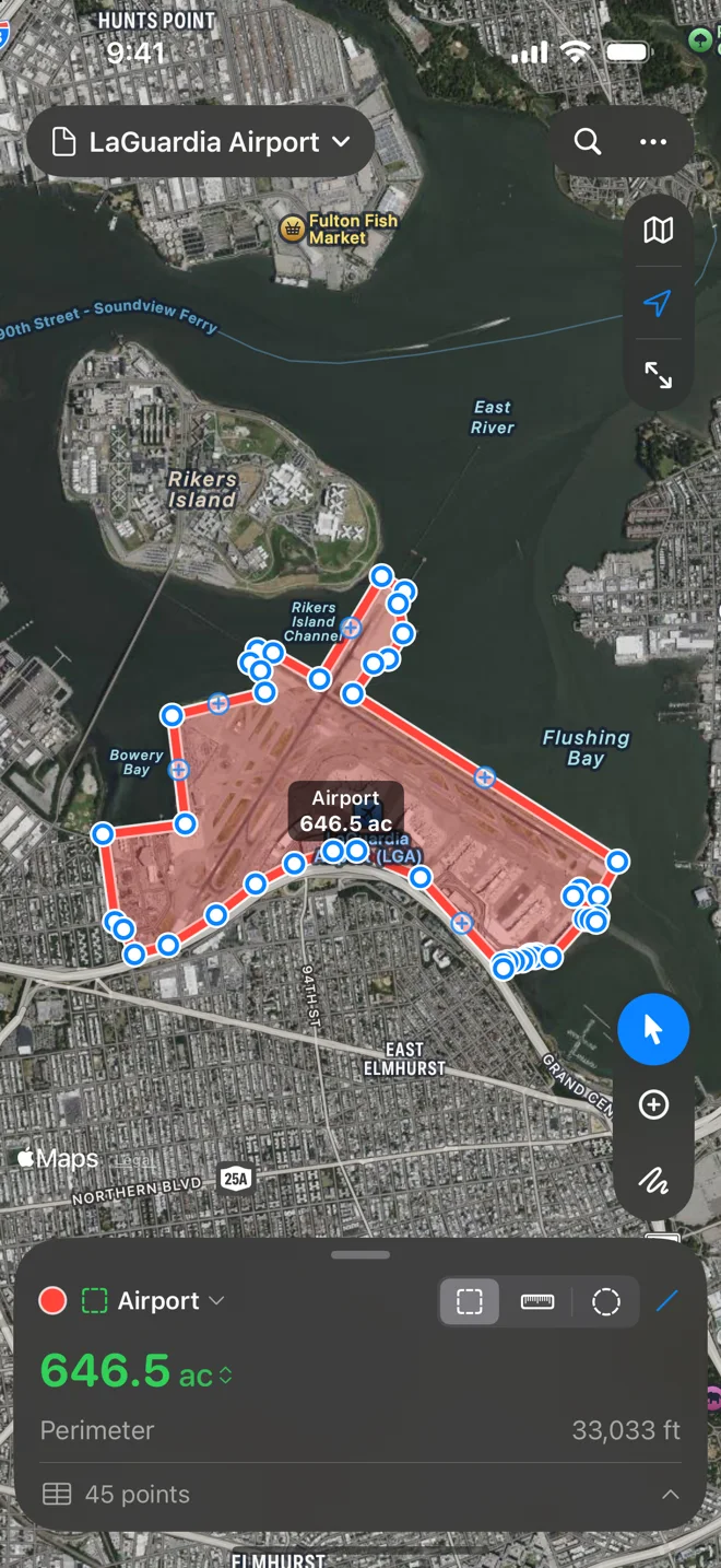
The start screen. Geo Measure opens on it: Measure an Area, Measure a Distance, Walk the Boundary, Open a File…, Open the Sample and your recent files. Home in the document menu goes back to it. See The start screen.
Gestures. In Add Points, tap the map to add a point. Pan with one finger, zoom and rotate with two. Press and drag a point to move it; tap it for its callout; tap a hollow midpoint to add a point on an edge. In Freehand, one finger or Apple Pencil draws instead of panning.
iPhone. At the top: the document’s name (its menu: Home, New, Open…, Save, Save As…), Undo and Redo while you draw or have something to undo, Search, the More menu (•••), and Done while drawing. More holds Share, Export, Import…, Print…, Rename…, Delete Point, Delete for the selected shape, Delete All…, Help and Settings. Down the right edge: map style, your location (tap to follow it) and Fit. The tools sit in a capsule above the card, where your thumb is. The card shows the shape’s color, the shapes menu (the layers, new shapes, Rename…, Hide Layer, Arrange, Delete), the kind picker, the routing menu, the number and its unit, and the point count; with nothing selected, the totals, a chip per shape and the + menu. Settings › Map › Glass draws the floating controls Automatic, Clear or Frosted.
The points sheet opens from the point count. When you pick a point, it drops low so the point stays in view above it while you nudge it.
iPad has the Mac’s layout: a toolbar (the document menu, Undo, Redo, Search, Fit, the points table, then +, More, map style, Share, Settings), the floating panel with the layers, and the points table under the map. With a keyboard, the Mac’s shortcuts work. You can drop files from another app onto the map to import them.
Walking the boundary. On iPhone and iPad, Walk the Boundary (start screen or + menu) measures a field as you walk its edge, with the phone in your pocket and the screen locked. It comes with Geo Measure Pro; see Walk the boundary.
On iPhone Duo
Section titled “On iPhone Duo”Closed, the outer display keeps a strip down its right edge for the camera, the time and Wi-Fi. Geo Measure puts its map controls (map style, your location, fit) in that strip under them and the tools (Select, Add Points, Freehand) at its foot; the document, Undo, Redo, More and Done stay along the top, and the measurement card at the bottom, beside the strip. A long document name shortens to make room. Open, the inner display has the iPad’s layout: the toolbar, the floating panel with the layers, and the points table.
On Apple Vision Pro
Section titled “On Apple Vision Pro”Geo Measure on Apple Vision Pro opens on the map and has the iPad layout: the map in a window, the toolbar, the floating panel and the points table. Look at a spot and pinch to add a point. Documents, routing, layers, the points table, import and export work as on iPad; Track My Position in the + menu adds points as you move, while Geo Measure is open.