
Holes, Simplify, Reverse and conversions
These need KML Explore Pro. They are in the inspector’s Shape section while editing, and on the Mac in the Draw menu. Each is one step of undo and leaves the rest of the file as it was.
Add a hole
Section titled “Add a hole”A hole is an inner boundary: a pond in a field, a courtyard in a building. Its area is left out of the area’s total, a click inside it doesn’t select the area, and My Location counts it as outside.
- Select the area, then choose Add a Hole in the inspector’s Shape section, Add a Hole to … in the edit bar’s + menu, or on the Mac Draw ▸ Add a Hole.
- Click (tap) inside the area where the hole starts. A click outside the area makes no hole and says so. On iPhone the inspector closes first, so the map is free to tap.
- Click (tap) its corners. End it as you end a path: the ✓, Return, or another tool.
In an area of several parts (a state with islands), the hole goes into the part you click in. Holes are drawn straight, whatever the edit bar’s Lines say. A hole’s points are in the Points table as Hole 1, Hole 2, and deleting all of them, or leaving fewer than three, removes the hole.
Simplify
Section titled “Simplify”A freehand trace or a line along roads has many more points than its shape needs, and some GPS units and apps take only a few hundred. Simplify… takes out the points close to a simpler line.
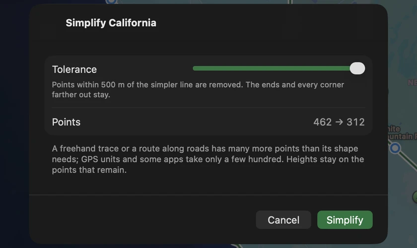
Choose Simplify… in the inspector’s Shape section (on iPhone the inspector closes and the sheet opens), or on the Mac Draw ▸ Simplify…. Drag Tolerance: points within that distance of the simpler line go, while the ends and every corner farther out stay. Points shows the count before and after as you drag (California’s outline at 500 m: 462 → 312). Press Simplify. Every path, outline and hole of the placemark is simplified; an outline keeps at least three points and a path two, and heights stay on the points that remain. The tolerance is remembered.
Reverse
Section titled “Reverse”Reverse (on the Mac, Draw ▸ Reverse Direction) puts a path’s points in the other order, so it runs the other way. For an area it reverses the outline and holes.
Make an Area, Make a Path
Section titled “Make an Area, Make a Path”- Make an Area turns a path into an area with the path as its outline, so it has an area, a perimeter and a fill. It needs at least three points.
- Make a Path turns an area’s outline into a path that goes all the way round. Its holes become paths too.
The placemark stays where it was, with its name, description, attributes, time and id. The shape’s own settings (height, extrude, tessellate) go with it. A path drawn in KML Explore takes its area style; a file’s path style with no fill gets a fill in its line’s color, so Google Earth doesn’t fill it white.
None of these apply to a circle, which is changed by its center and radius.