
KML Explore
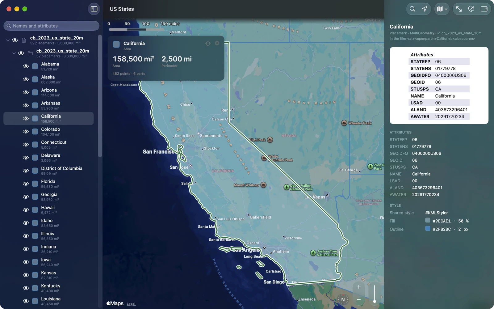
KML Explore opens any KML or KMZ file and shows everything in it, the way its author made it: every folder as a layer you switch on and off with its eye, every placemark drawn with the colors, lines and icons the file gives it, and each one’s description, attributes and measurements. Files from Google Earth and My Maps, county and state GIS portals, survey and farm software, and the agencies that publish KML feeds all open, and so do many with common errors: KML Explore repairs a copy and says what it fixed.
Then it edits the file, keeping the rest of it. Draw placemarks, paths, areas, circles and rectangles, move points to the centimeter, change names, attributes and styles. Saving keeps the file’s other KML, including the extensions and schemas KML Explore doesn’t edit, so Google Earth and other apps open it as before.
It runs on Mac (macOS 15.4 and later), iPhone and iPad (iOS and iPadOS 18 and later). Viewing is free; editing and export come with KML Explore Pro, one purchase in the app.
Your first file in a minute
Section titled “Your first file in a minute”-
Open a file. On the Mac, double-click a .kml or .kmz file in Finder, or choose Open a File… in the welcome window. On iPhone and iPad, tap the file in Files, Mail or Messages and choose KML Explore, or choose Open a KML or KMZ File… on the start screen. No file handy? Open one of the six Samples: Google’s KML samples, the US states, the counties, a week of earthquakes, a day of fires, a storm outlook. See Open KML and KMZ files.
-
Switch layers. The eye beside each folder and placemark in the layer list shows or hides it, as Google Earth’s checkboxes do. Your switches are kept on this device, never written into the file. See The layer list.
-
Click a placemark. On the map or in the list. Its card shows the numbers that matter (area and perimeter, length, position), and the inspector opens with its balloon, attributes and style. Tap an area or a length on the card to change its unit. See The map and the card.
-
Find your way. The magnifying glass finds a place, an address or coordinates; the location arrow shows where you are and how far each placemark is. See Find a Place and My Location.
-
Edit, if you like. Press Edit (the pencil; ⌥⌘E on the Mac) to draw and change the file. Every change can be undone. See Edit a file.