
Export to GPX, GeoJSON and CSV
Export needs KML Explore Pro. It writes a copy of the placemarks in another format; the KML file itself is untouched.
On the Mac choose File ▸ Export… (⇧⌘E). On iPhone and iPad, tap File at the top left of the map, then Export….
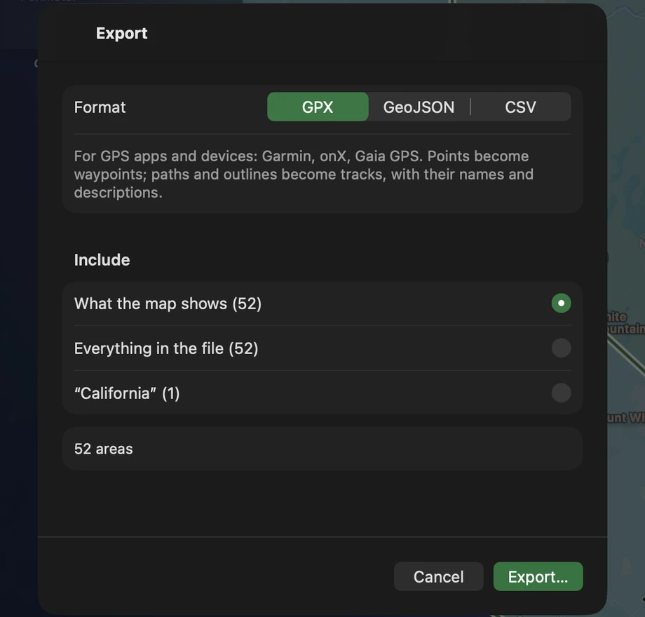
- Choose the Format: GPX, GeoJSON or CSV. The choice is remembered.
- Choose what to Include, each with its number of placemarks: What the map shows (the layers switched on), Everything in the file, or the selected folder or placemark by name. With a folder selected, it starts on that folder.
- Check the line under it: how many points, paths and areas go. Overlays, network links and placemarks with no place stay out, and the sheet says how many.
- Press Export… and choose where to save. The file is named after the KML.
What each format keeps
Section titled “What each format keeps”| GPX | GeoJSON | CSV | |
|---|---|---|---|
| For | GPS apps and devices: Garmin, onX, Gaia GPS | Web maps, QGIS, code | Spreadsheets, QGIS |
| Points | Waypoints | Point features | A row each: latitude, longitude, altitude_m |
| Paths | Tracks | LineStrings | A row each, with length_m |
| Areas | Tracks around the outline (holes as more segments) | Polygons with their holes | A row each, with area_m2 and perimeter_m |
| Circles | The outline as a track | A Polygon with radius_m |
A row with its center, area and perimeter |
| Names, descriptions | Yes (descriptions as plain text) | Yes | Yes (descriptions as plain text) |
| Folder | In <type> |
folder |
A column |
| Attributes | Every attribute | A column each | |
| Colors | stroke, fill, marker-color (geojson.io and GitHub draw them) |
||
| Time | A time stamp, and gx:Track’s times | timestamp, or begin and end; gx:Track’s coordTimes |
|
| Shape | WKT, which QGIS reads as a layer |
Some details:
- GPX writes an elevation only where the file says its heights are above sea level: KML’s default puts things on the ground, whatever the numbers say.
- GeoJSON follows RFC 7946: outlines counterclockwise, holes clockwise, rings closed. A placemark of several parts is a Multi… geometry or a GeometryCollection. An attribute named like a built-in property gets “ (data)” after its name.
- CSV is UTF-8 with a byte order mark, so Excel reads accents right. Text a spreadsheet would run as a formula starts with an apostrophe.
- Coordinates keep the digits the file has.
Save and share the KML itself
Section titled “Save and share the KML itself”- On the Mac, the file saves itself; File ▸ Duplicate and File ▸ Save… (for a sample or a new map) keep a copy, as KML or KMZ.
- On iPhone and iPad, File ▸ Share… sends the file (Mail, Messages, AirDrop, another app), and File ▸ Save… gives a new map or a sample its file.
A KMZ saves as a KMZ, with its icons and pictures inside.