

Edit a file
Editing needs KML Explore Pro.
Press Edit (the pencil in the toolbar), or on the Mac choose Draw ▸ Edit (⌥⌘E). The edit bar appears over the map: at the top right beside the inspector on the Mac and iPad, at the top of the map on iPhone. Under it, a line says what a click (tap) does now. Press Done (⌘↩) to stop editing; on the Mac, Draw ▸ Stop Editing (⌥⌘E) does the same.
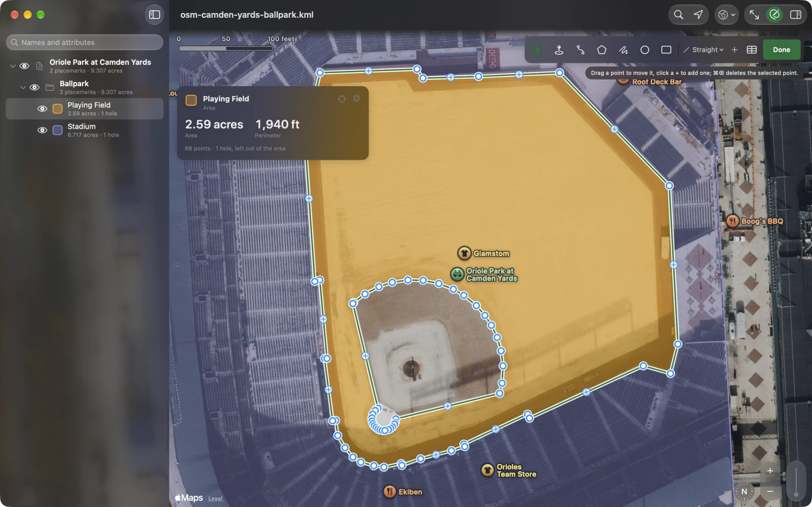
While editing, the inspector turns into fields (Names, attributes and styles), and selecting a hidden placemark shows it. On iPhone the card and the web question step aside so the map is free, and the inspector waits for its button.
The edit bar
Section titled “The edit bar”From left to right:
- The tools (below).
- Lines: how a path’s or an area’s next leg is drawn: Straight Lines, Follow Paths (Walking), Follow Roads (Cycling) or Follow Roads (Driving). Remembered.
- +: New Placemark, New Path, New Area (the next click starts a new one, whatever is selected), New Folder, and for a selected area Add a Hole to ….
- Undo and Redo (iPhone and iPad; on the Mac, Edit ▸ Undo ⌘Z and Redo ⇧⌘Z).
- Points (the table icon), for a selected placemark with points: the Points table (⌥⌘P).
- ✓ (End Drawing), while a path or area is being drawn: ends it, and the next click starts a new one.
- Done.
Where the map is narrow (an iPad in portrait with both panels open), the bar takes two rows.
The tools
Section titled “The tools”| Tool | Mac | What a click (tap) does |
|---|---|---|
| Select and Move | ⌃⌘1 | Selects a place, path or area; drag its points to move them. See Points. |
| Placemark | ⌃⌘2 | Drops a placemark where you click. |
| Path | ⌃⌘3 | Adds a point to the selected path, or starts a new one. |
| Area | ⌃⌘4 | Adds a point to the selected area’s outline, or starts a new area at its first corner. |
| Freehand | ⌃⌘5 | Drag on the map to trace a path. One stroke, then the tool goes back to Select and Move. |
| Circle | ⌃⌘6 | Places a circle centered where you click, a sixth of the map across. |
| Rectangle | ⌃⌘7 | Click one corner, then the opposite one: an area with north-south and east-west sides. |
On the Mac the tools are also in the Draw menu, and ⌥-drag with Path or Area traces freehand into the path or area being drawn.
New things are named Placemark 1, Path 2, Area 3, Circle 4, Rectangle 5 (one more than the highest number already in the file) and selected at once. Rename them in the inspector.
Paths and areas
Section titled “Paths and areas”With Path or Area, each click adds a point to the end. The shape stays open for more until you end it: press Return or Esc (Mac), the ✓ in the edit bar, or Draw ▸ End Path or Area; picking another placemark or tool ends it too. A path left with one point, or an area with fewer than three, is taken away (undo brings it back to finish).
A trace is simplified as it is drawn, to about four screen points, so a wobbly hand doesn’t leave thousands of points. Simplify… takes out more.
Circles and rectangles
Section titled “Circles and rectangles”KML has no circle, so KML Explore writes one as Geo Measure does: the center as a point and the outline as an area of 120 points at the radius, with the radius in meters as an attribute. Google Earth shows it as a round area with a pin; KML Explore edits it as a circle.
A circle shows two dots: drag the middle one to move it, the one on the edge to size it (the radius shows while
you drag). Type a radius in the inspector’s Circle section: 250 m, 0.5 mi, 800 ft, or a number alone in
the unit shown. Typing a new value into its radius attribute resizes it too. Radii go up to 5,000 km. Point
by point tools (holes, Simplify, Reverse, the Points table) are off for a circle; to work on its points, draw an
area.
The card shows a circle’s Area and Radius; the inspector, its area, circumference and center.
Lines along paths and roads
Section titled “Lines along paths and roads”With Follow Paths (Walking), Follow Roads (Cycling) or Follow Roads (Driving) chosen, each new leg of a path or an area’s outline follows the way Apple Maps would take between your two clicks. The leg is dashed while Apple Maps works it out (Finding the way…). Where it finds none, the leg is drawn straight and the line under the edit bar says so. Holes are always drawn straight.
Routing sends the two ends of each leg to Apple Maps. Straight Lines sends nothing.
Where new things go
Section titled “Where new things go”A new placemark or folder goes into the selected folder, or right after the selected feature in its folder; with nothing selected, into the file’s top folder. What you draw uses three shared styles KML Explore adds to the file once (one each for points, paths and areas), so it opens in Google Earth looking as it does here. A style change in the inspector applies to one placemark unless you choose every placemark using the style; see Styles.
Every change is one step of undo, named after what it did (Undo Move Point, Undo Add Hole). A run of moves of one slider or color picker is one step. On iPhone and iPad, use the arrows in the edit bar.
Saving
Section titled “Saving”On the Mac a file saves itself, as KML or KMZ, whichever it is. On iPhone and iPad, edits are written back to the file a moment after the last one and when you leave the app; a new map or a sample waits for File ▸ Save…. See Open KML and KMZ files.