

Save, share and export
Saving
Section titled “Saving”GPX Explore saves the document by itself as you edit; there is nothing to remember. On the Mac the usual File menu commands are there (Save, Duplicate, Rename…, Move To…, and Revert To for earlier versions). On iPhone and iPad the file is saved where it is; rename, move or duplicate it in the Files app. A new track has no file until you choose Save… in the folder menu; leaving it first asks whether to keep it.
It writes GPX 1.1 and keeps everything it read: the file’s metadata and links, waypoints with their symbols, routes, segments, fix quality, heart rate, cadence and power, and other apps’ extensions with their namespaces. A file you open and close without editing is written back byte for byte, and an edited file keeps the name of the app that created it.
The Share menu
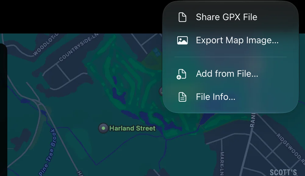
Section titled “The Share menu”The Share button in the toolbar (the square with an arrow) has:
- Share GPX File: the file through the share sheet (Mail, Messages, AirDrop, Files, another app). With unsaved edits, it shares the file as it is now.
- Export Map Image… (⇧⌘E): a picture, below.
- Print… and Save PDF… (on the Mac PDF Report…, and File ▸ Print…, ⌘P): a report on paper or as a PDF, below.
- Add from File…: adds the tracks, routes and waypoints of one or more other GPX files to this one, in one undoable step. Needs Pro. On the Mac also Track ▸ Add from File… (⇧⌘I).
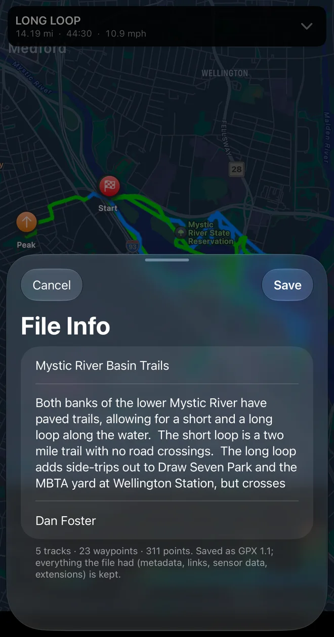
- File Info…: the file’s Name, Description and Author, with a count of its tracks, waypoints and points. Saving changes needs Pro.
Print or save a PDF report
Section titled “Print or save a PDF report”Print… opens the print sheet: the page as it will print, beside the choices on the Mac and above them on iPhone and iPad. Choose what goes on it, then Print… or Save PDF…. Printing is free; it does not need Pro.
- Tracks: all the visible tracks, or only the selected one (when the file has several).
- Map: on or off, its style (Standard, Muted, Satellite or Hybrid), the start and end of each track, and the waypoints as numbered dots.
- On the page: the statistics (with the date the track was recorded), the elevation profile (and, if the file has one, a second line such as heart rate), the splits, the climbs and the waypoints table. With Climbs on, each climb is shaded on the profile in its category’s color and numbered as in the climbs table: its category, where it starts, its length, gain, average grade and steepest 100 m.
- Cue Sheet: every turn on pages of their own, below.
The choices are remembered for the next report. The footer of each page has the date it was printed and the page number; a long file runs onto several pages, with each table’s header repeated.
A cue sheet to tape to the stem
Section titled “A cue sheet to tape to the stem”Turn on Cue Sheet and the report ends with the route’s turns on pages of their own, in large type: for each one the distance from the start (Total) and from the last cue (Leg), to the hundredth of a kilometer or mile, an arrow, and what to do there: “Turn left onto Rue de l’Église”, “Bear right”, “Arrive at the end of the route”. Waypoints near the route come in order with their names, and each climb is a line where it begins, with its category, length, grade and gain. The turns are the ones riding a route announces, found from the shape of the line.
Street names are looked up from Apple Maps while the print sheet is open, about one a second; the footer under the switch counts them (“Looking up street names (12 of 40)…”) and the page fills them in as they come. Print at any time; turns whose street is not known yet just say “Turn left”. Without a connection the cue sheet prints without street names.
The cue sheet follows the visible tracks joined in order, as a ride follows them, so a file whose tracks leave a gap reads a little longer on the cue sheet than on the route card.
Export the map as a picture
Section titled “Export the map as a picture”Export Map Image… draws the visible tracks on an Apple map in their on-screen colors, with the chart under the map in the series it shows, and a band with the track’s name and its distance, moving time, gain and start date. The picture is a PNG, 3200 pixels wide. Share it, or on the Mac Save… it.
The picture uses the map style chosen in the toolbar, so switch to satellite first for an aerial view.