

The map and the grid
Map shows the grid over the map, the way a paper map has it. The map’s pictures come from Apple Maps and need a connection. The grid, the crosshair and the ruler do not.
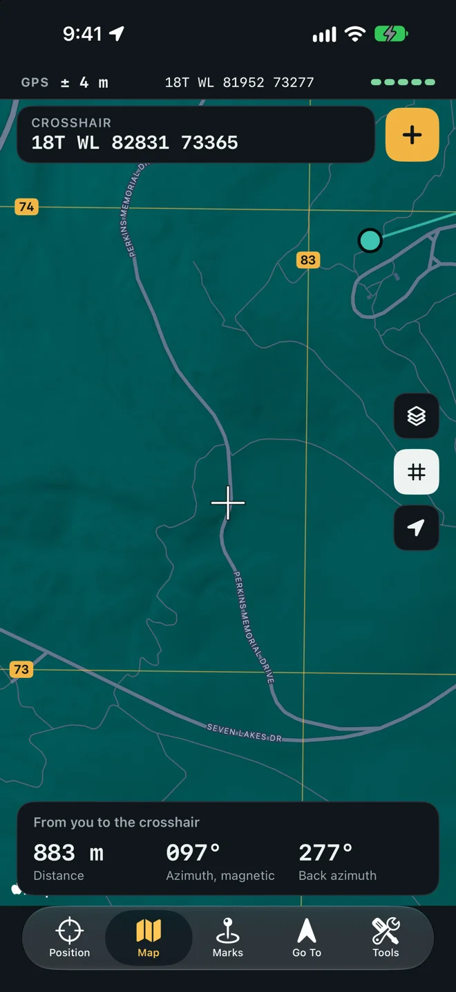
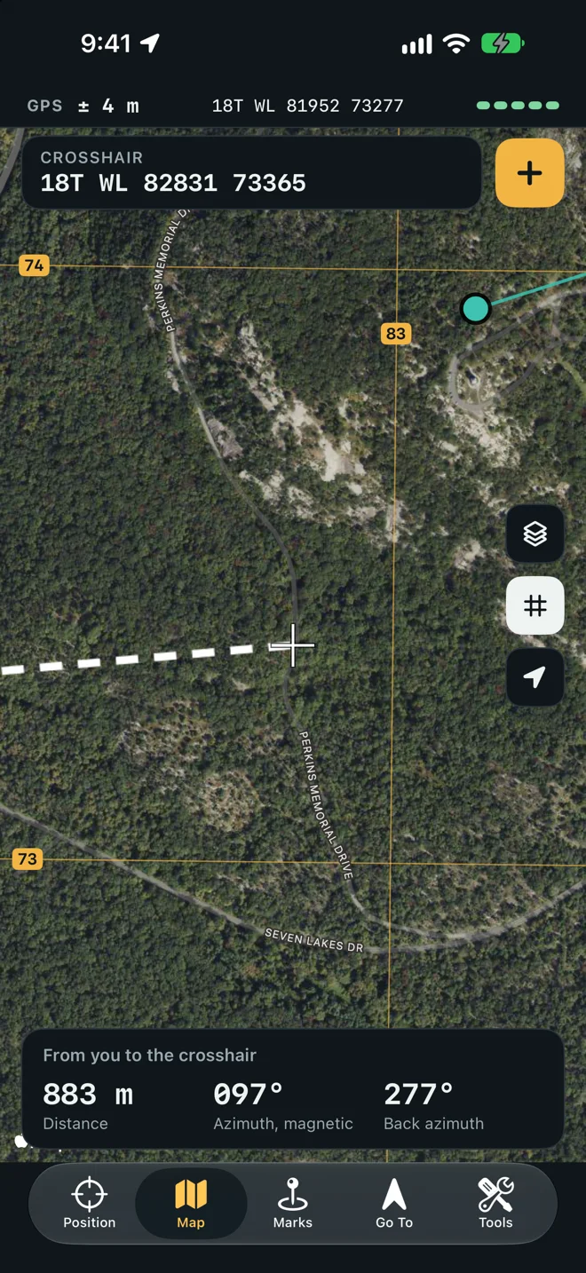
Grid lines
Section titled “Grid lines”The lines are the UTM grid that MGRS is built on, drawn in each zone the map touches and cut at the zone edges. Their spacing follows the zoom, so there are never more than about fourteen across the screen.
| Spacing | Label on a line |
|---|---|
| 100 m | Three digits, such as 826 |
| 1 km | Two digits, such as 82, the digits a paper map prints on its kilometer lines |
| 10 km | One digit |
| 100 km | None |
Zoomed out past about 14° of latitude or longitude, and beyond 84° north or 80° south, no lines are drawn.
The grid button on the right (Hide the grid / Show the grid) turns the lines off and on. So does Grid Lines in Settings.
The crosshair
Section titled “The crosshair”The white cross stays in the middle of the map. The Crosshair box at the top reads the grid under it as you drag. Tap the box to copy that grid.
Tap + beside the box to make a mark at the crosshair. New mark opens with the position fixed; name it, pick a folder and tap Save.
The ruler
Section titled “The ruler”A dashed white line runs from you to the crosshair, and the card at the bottom reads it:
- Distance
- Azimuth, with the north it is from (Azimuth, grid)
- Back azimuth
The title says From you to the crosshair.
Measure from a mark
Section titled “Measure from a mark”Tap a mark’s pin and choose Measure from Here. The ruler now starts at that mark, and the title reads From the mark’s name to the crosshair. Tap From me on the card to start it at your position again.
This is how you read a leg off the map before you walk it: put the ruler’s start on one mark and the crosshair on the next.
Marks on the map
Section titled “Marks on the map”Each mark is a pin in its symbol, colored by its folder. Tap one for a menu:
- Go To starts a leg to it. See Go To a mark.
- Measure from Here starts the ruler at it.
- Copy Grid copies its MGRS reference.
Course lines
Section titled “Course lines”The marks of each folder are joined by a line in the folder’s color, in the order the marks were made. A folder with one mark has no line. See a folder as a course.
Map styles
Section titled “Map styles”The layers button on the right opens Map style: Standard, Satellite or Hybrid. The same choice is Style in Settings. Standard and Hybrid leave out points of interest, so the grid and your marks stay readable.
Your location and north
Section titled “Your location and north”The location button (Show my location) brings the map back to where you are. The map also carries Apple’s compass and scale.